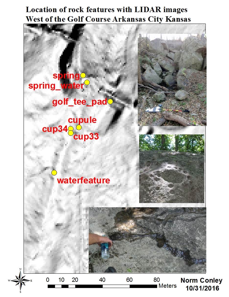
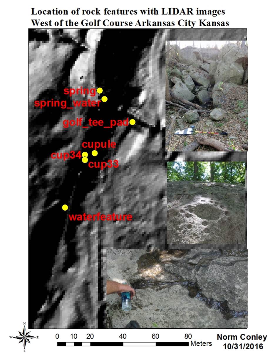
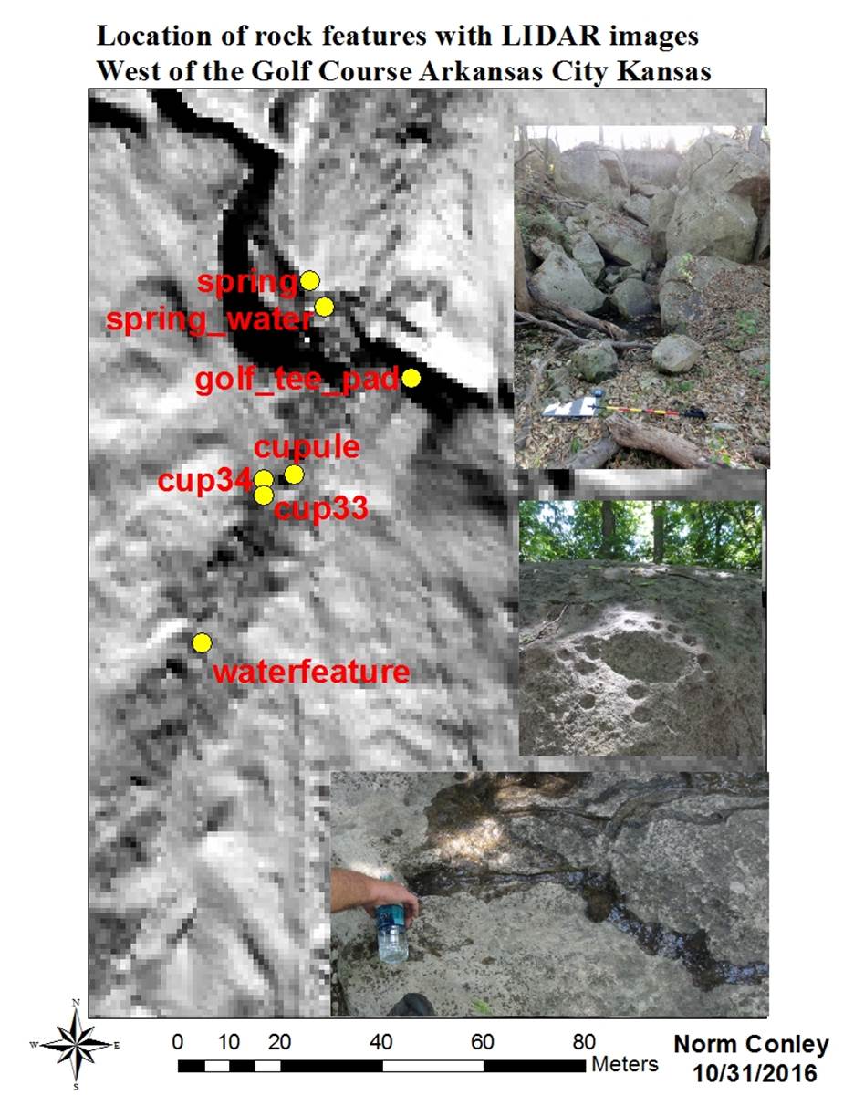
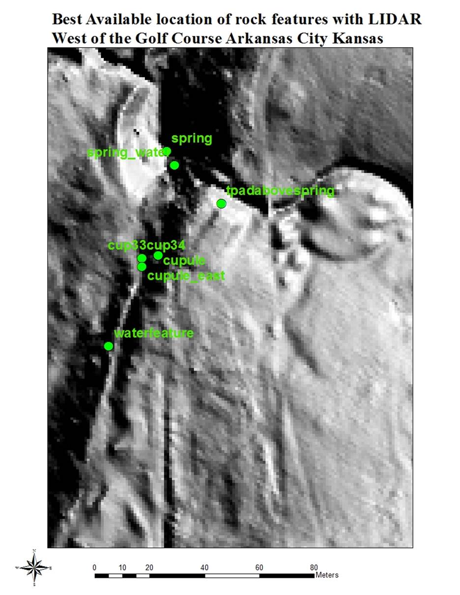
This is a review of Maps produced in
support on Archaeology of the Heartland.
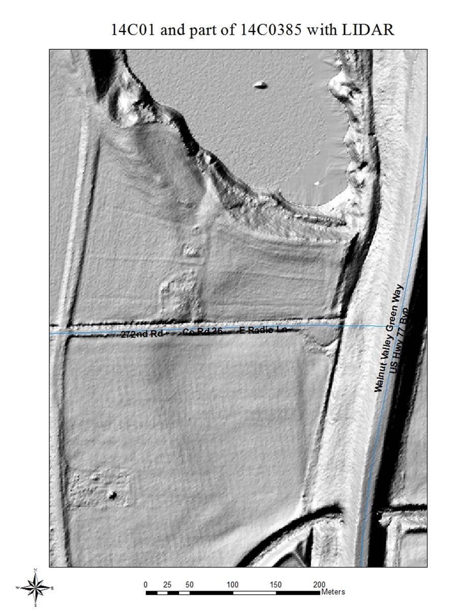
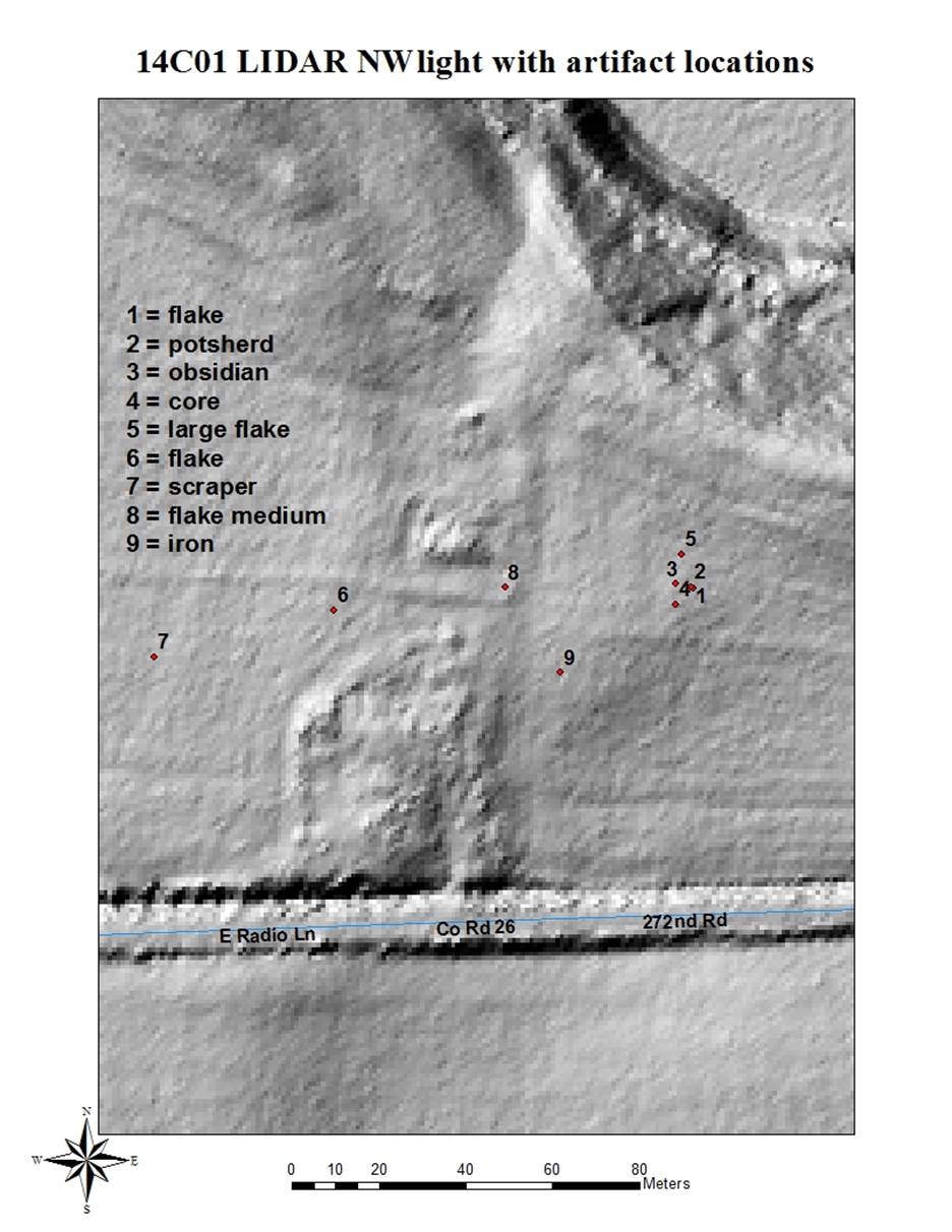
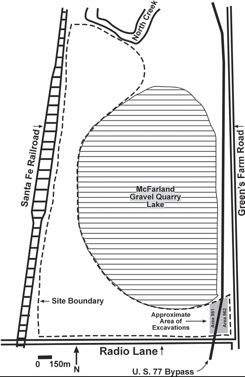
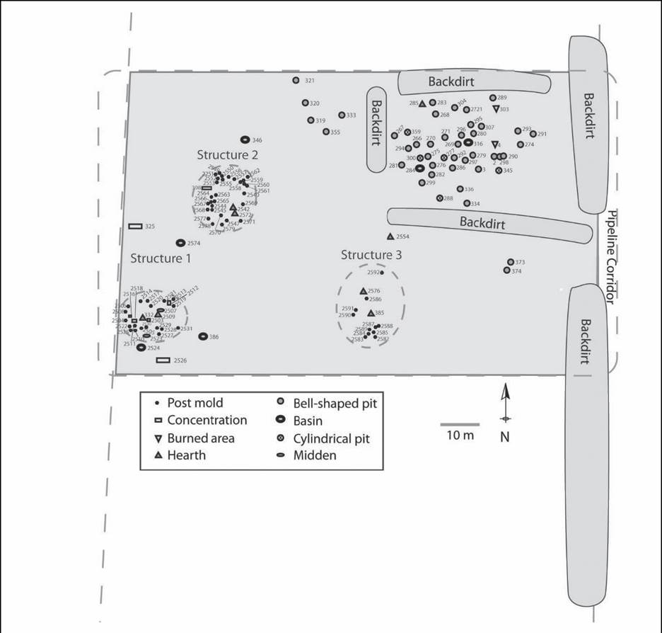
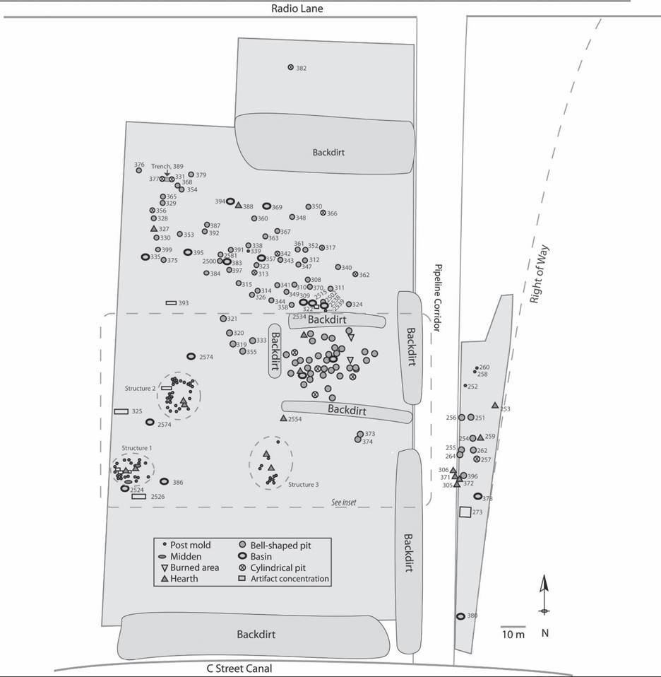
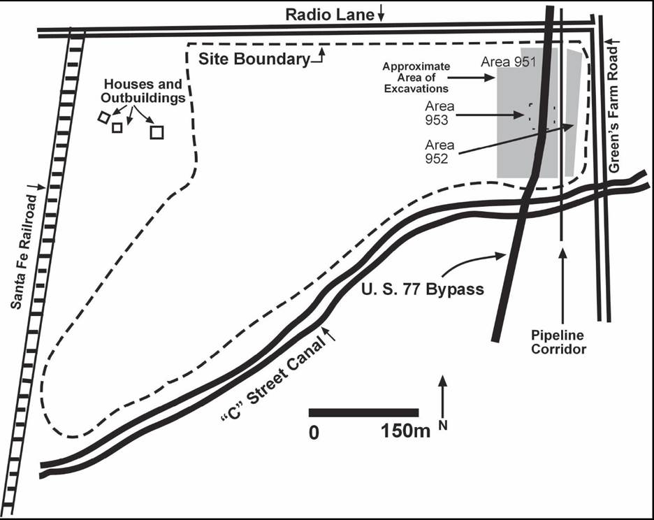
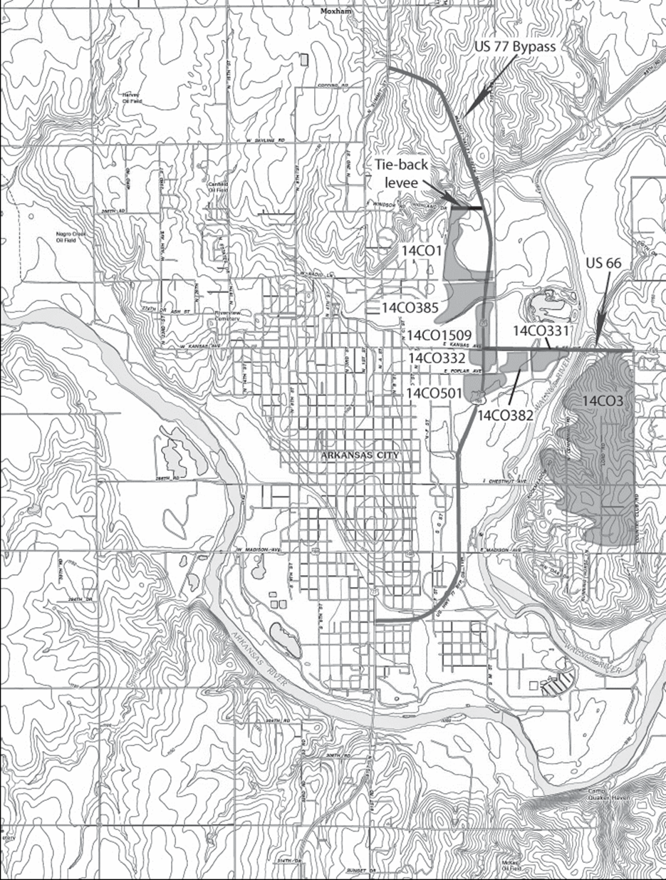
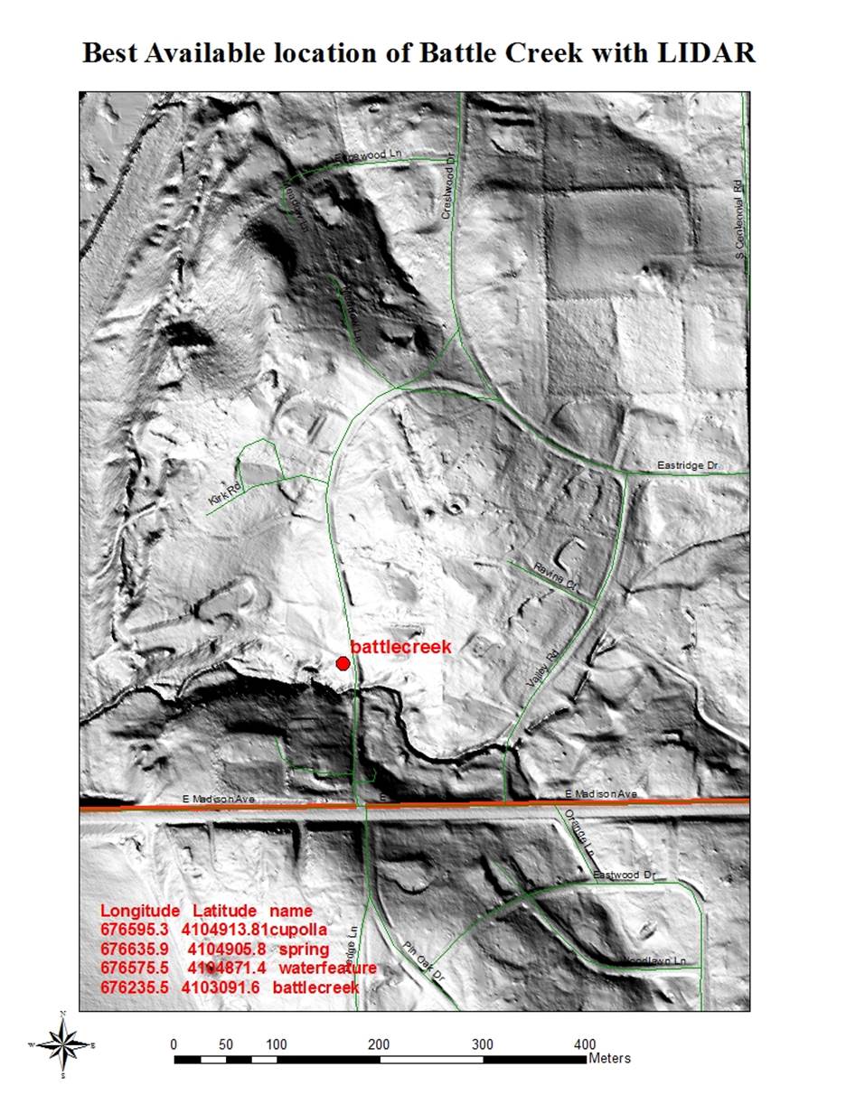
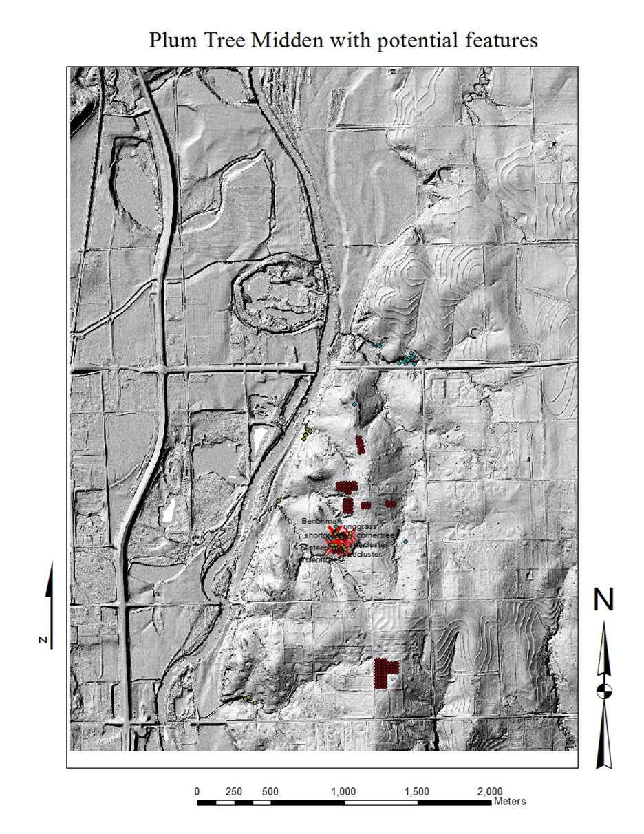
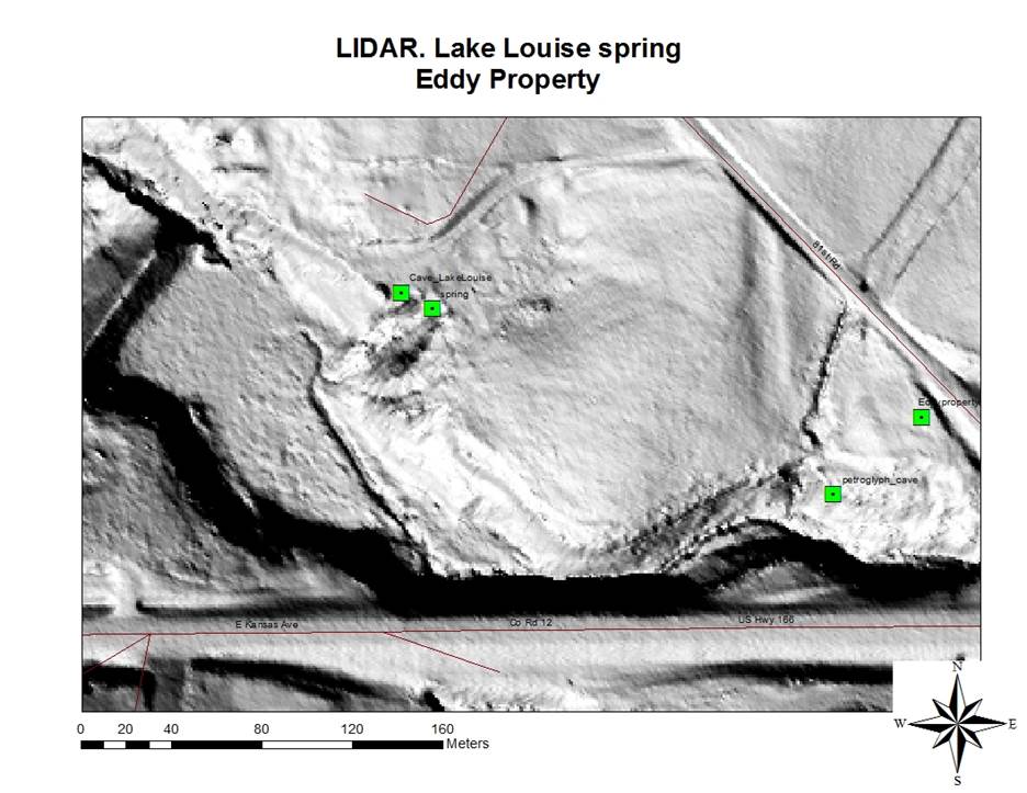
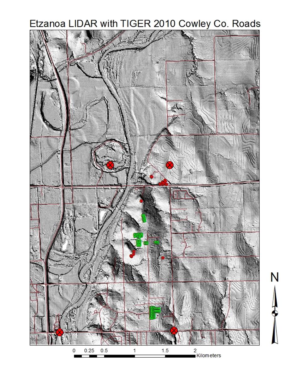
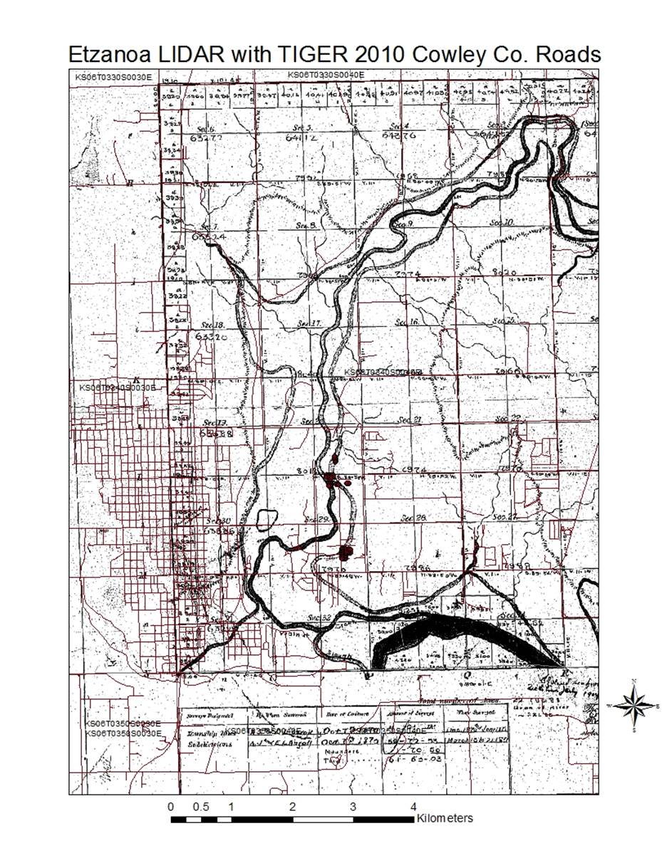
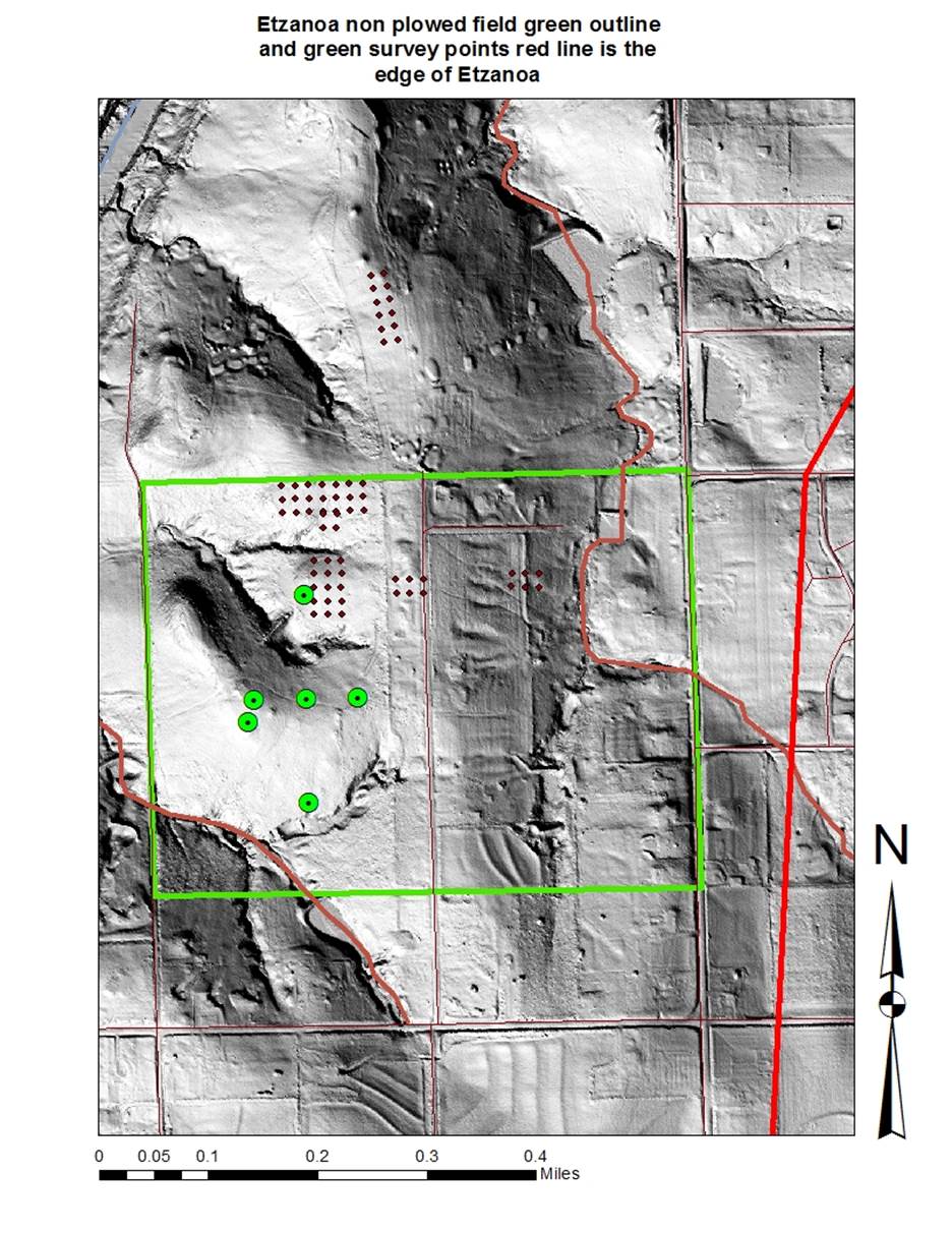
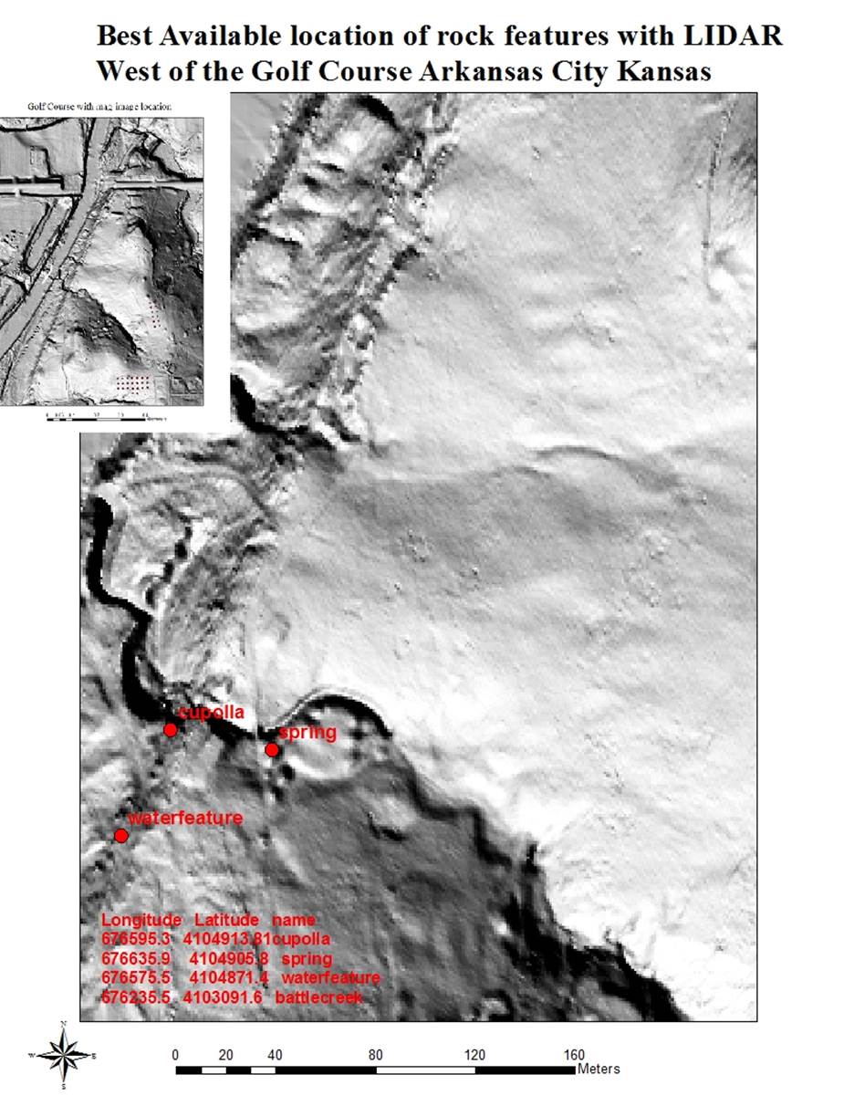
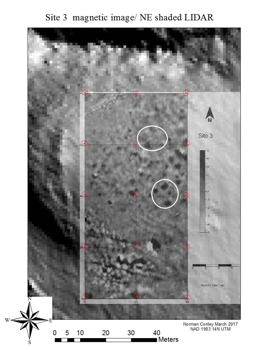
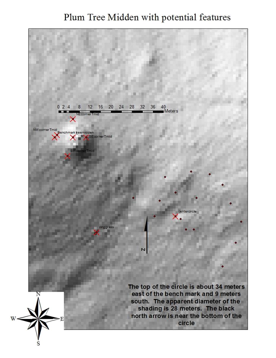
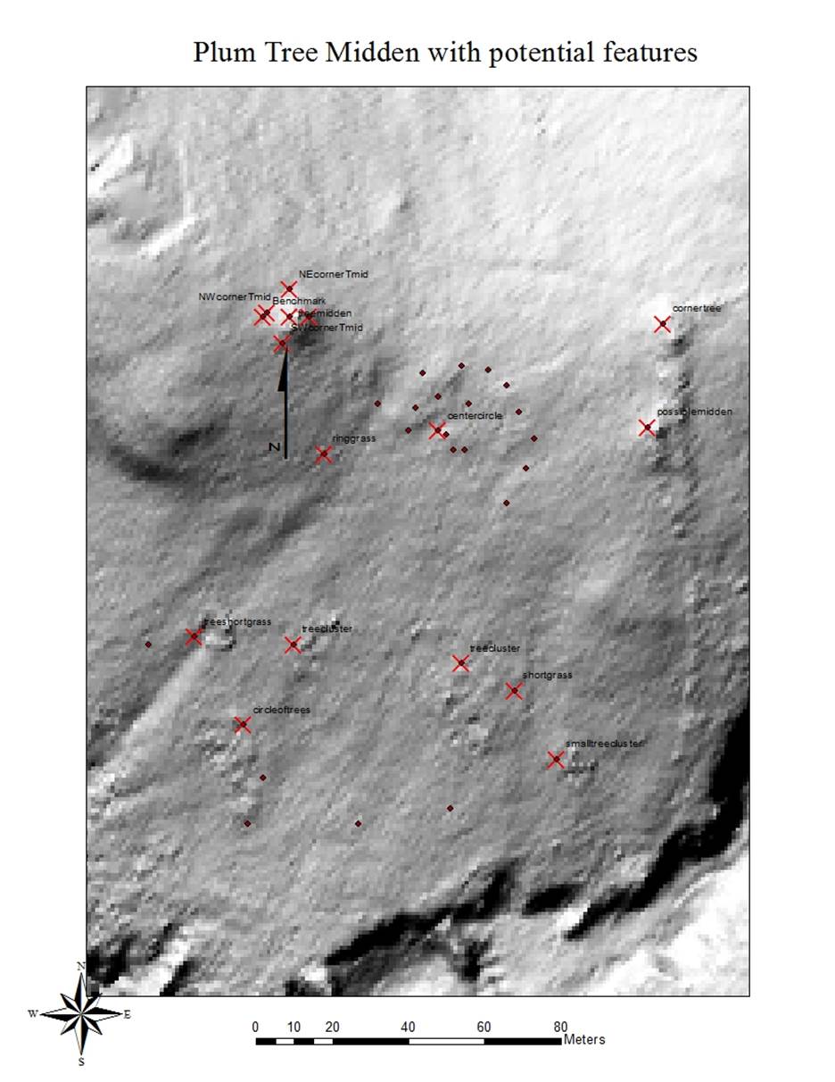
The data focus’ on The Area called the Great Settlement by the indigenous
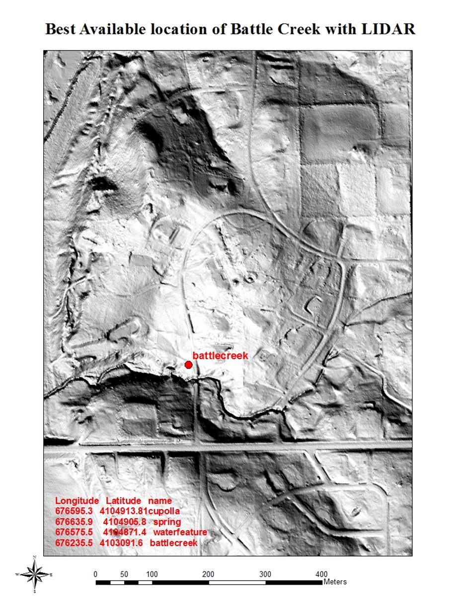
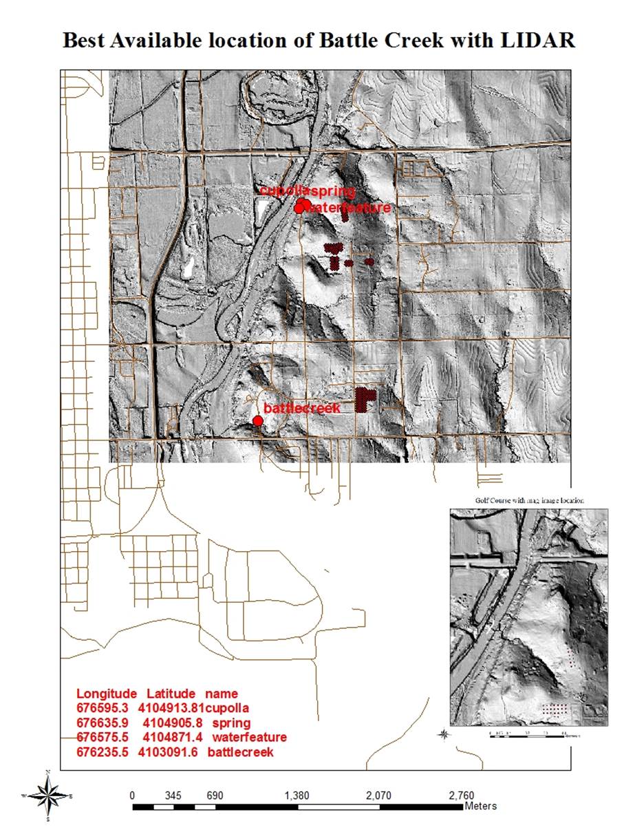
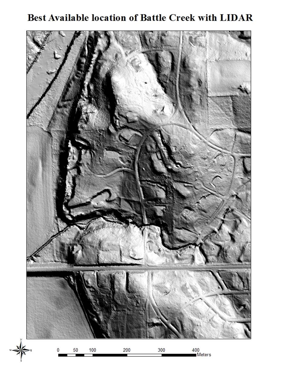
people and Etzanoa by the Spanish. The general LIDAR data for Kansas is 2 meter accuracy and for Etzanoa
is 1 meter, while finer increments are desired for areas that have been
designated at of interest for further study.
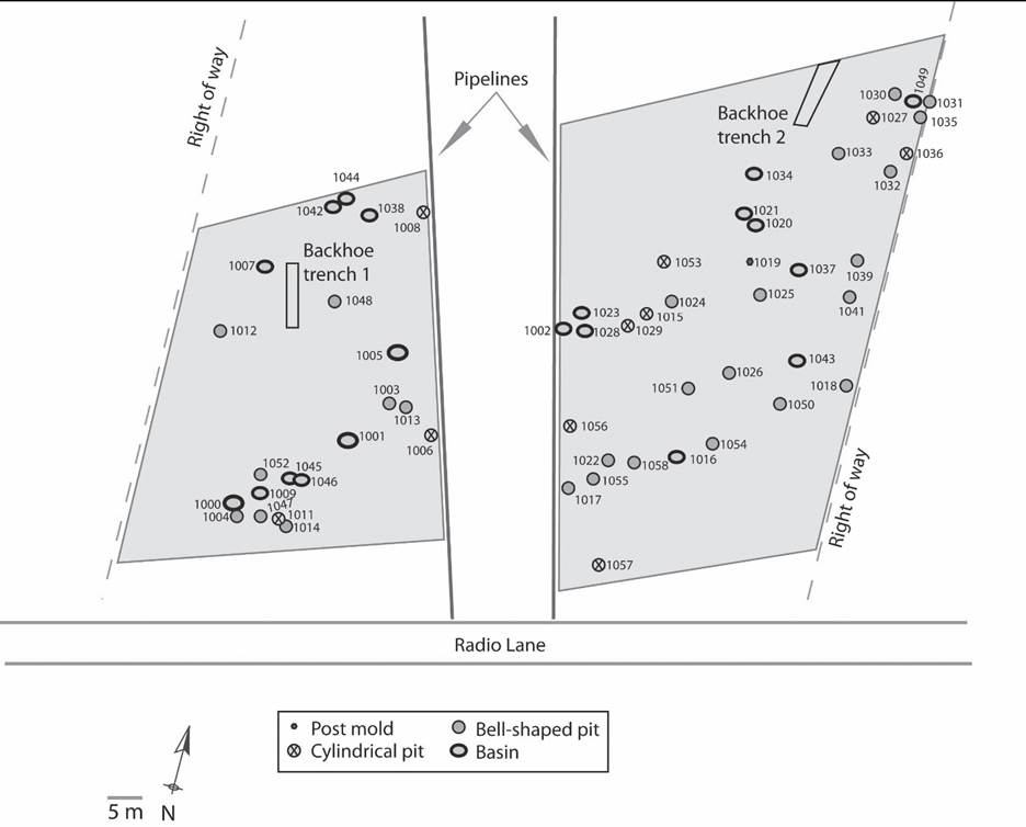
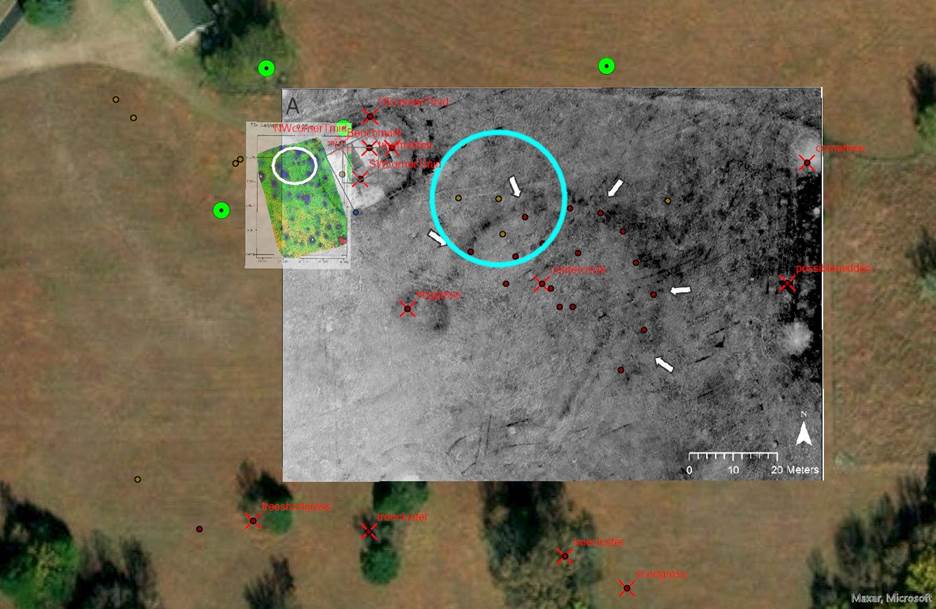
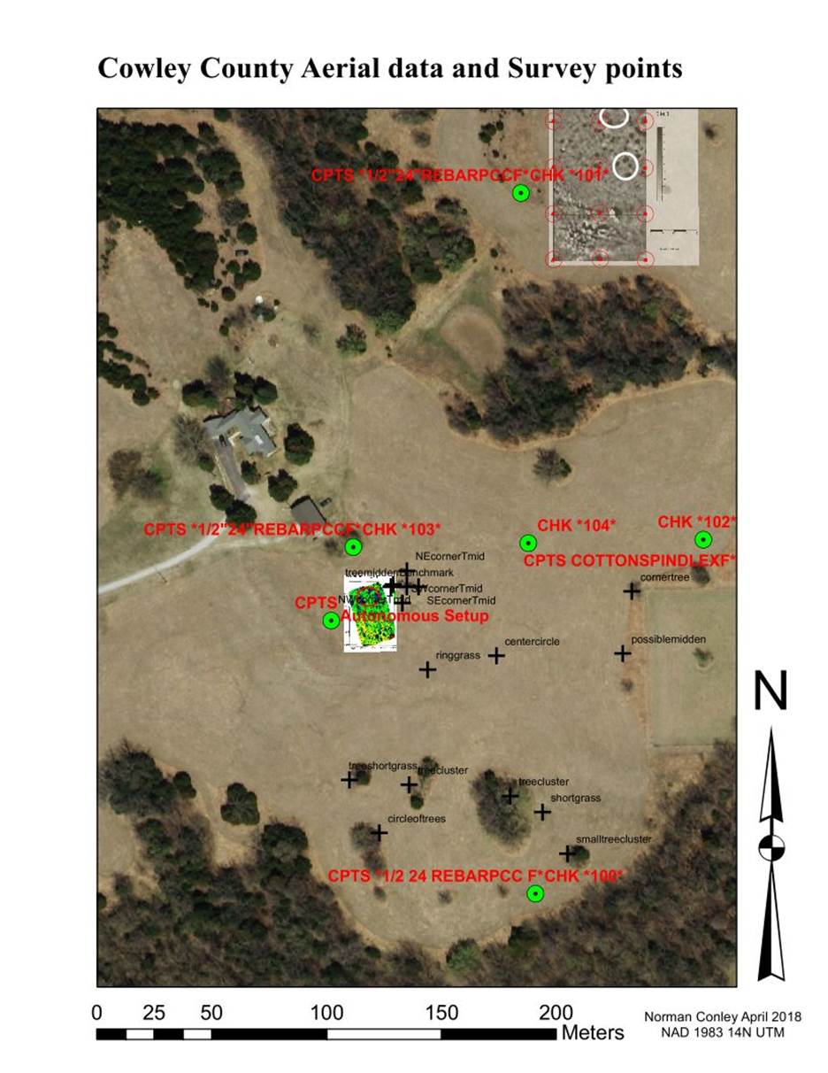
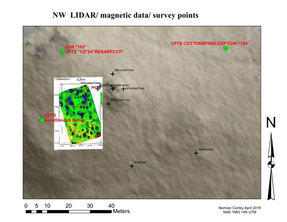
The focus is not on historical data but on the maps produced since 2014.
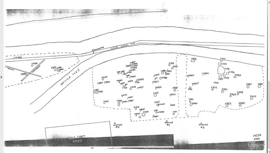
The first maps were generated from a
report on the sights by Marvin Hawley and earlier work sited in this report by the
Smithsonian and reports of earlier digging by locals reported in newspapers.